TEN-T Donegal / TEN-T Dhún na nGall
- What is the project? The project is called the ‘TEN-T Priority Route Improvement Project, Donegal’. A project description can be found on the Home Page of the donegal-ten-t website.
- Is this a single project or three individual projects? Will the project be funded as one or separately? This is one single project that incorporates 3 different sections of national primary road (as outlined on the Home Page).
- What is the relevance of input from members of the public? The Design Team will consider all inputs from members of the public such as feedback or identification of local issues. This will contribute to the development of route selection process and scheme design.
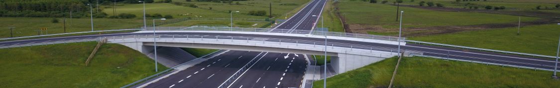
- What is the Need for the Project? The project aims to deliver on the strategies and objectives of the recent National Development Plan (NDP) and National Planning Framework (NPF) - Project Ireland 2040. As with previous projects, the scheme will address the continuing main issues of congestion, safety and journey time along the national and the TEN-T network. The project will improve connectivity within the county as well as regional and national accessibility to and from Donegal and the northwest.
- Will lands within the preferred corridor be subject to a planning hold? In general, lands within the preferred corridor will be subject to a planning hold however any planning application will be considered on a case by case basis.
- What will the status of bypassed sections of national roads be post completion? The status of bypassed sections of national road has not been determined at this time. Bypassed sections of national roads may remain as a national road or may be reclassified to regional or local roads following construction of new sections of the national route.
- How likely is the scheme to be built? All three sections of the project are identified as priorities within a list of key projects in the recently published National Planning Framework and National Development Plan. Advancement of the scheme is subject to ongoing funding and statutory approvals.
- Will the schemes involve demolition of property? The scheme is very large covering some 40/45km and with options skirting urban areas. It is certain that some residential property will be affected, and some may need to be acquired to facilitate the scheme. Each property is considered a constraint and in so far as possible, the scheme will seek to avoid and/ or minimise impacts.
- How will land be acquired? Will I be compensated? Given the scale of the project, it is likely that all lands required for the scheme will be acquired by a Compulsory Purchase Order (CPO). Should any part of a person’s land/ property holding be included in the CPO, the land/property owner is entitled to compensation. This may also be the case for a person who may have an interest in any land/ property identified in the CPO. Compensation will be provided in accordance with CPO legislation.
- What do the preferred corridors represent? The preferred corridors on this project are typically shown 300m in width. The preferred corridors do not represent the actual width of the road scheme or lands to be acquired. The corridors give an indication of the area within which it is intended to develop a road alignment. In some instances, the corridors may be increased or changed, typically to accommodate engineering needs, environmental assessments or to address feedback provided through the consultation processes.
- Has a traffic assessment been completed? Initial traffic data collection and assessment has taken place during Options Selection. Traffic modelling and assessment will continue during Phase 3 Design to ensure the proposed routes cater for predicted traffic volumes.
back to top